The humidity in Lima doesn’t just hang in the air; it saturates your clothes until they become part of your skin. I stood in the terminal of Jorge Chávez, sweat pooling in the pockets of my jungle-grade cargo pants, staring at a screen that told me I wasn’t going anywhere.
Sky Airlines had done it again—the digital bait-and-switch. Somewhere between the search and the final click, the booking had shifted a full week into the future. In Peru, logistics are a living thing, and they usually have a mean streak.
I didn’t get angry; I’ve been behind the gloss of this industry too long to let a botched ticket break my stride. I retreated to the airport bar and spent five hours in a vacuum of air-conditioning and cold drinks. By the time I boarded, the adrenaline of the mistake had faded into a flat, heavy exhaustion.
The Cold Intake
When the plane finally touched down in Cusco, the cabin door opened and I stepped into a refrigerator. It was 8:00 PM in February. The air wasn’t dry; it was damp and sharp, a mountain wetness that felt like it was searching for a way through my jacket.
The transition from 28°C in Lima to the 10°C dampness of the Andes is a thermal shock. It’s the kind of cold that stays in your bones long after you’ve gone inside. The airport was a frenetic chorus of “taxi, friend,” and a driver tried to tell me Uber was illegal.
It’s a local script, atmospheric but fictional. I flashed my resident ID, declined firmly, and got into an Uber. I had five hours to sleep before leaving for the lakes. I managed one.
I lay in a dark room in a friend’s house, suspended in that brittle, high-altitude alertness where your heart beats too fast for your rest level. My brain was looping a generic, corporate elevator melody—the kind of hollow music that plays when you’re stuck on hold.
Every time the building’s lift moved, the melody tightened. I wasn’t sleeping; I was just watching the light from a streetlamp leak through the curtains, waiting for the 2:00 AM alarm.
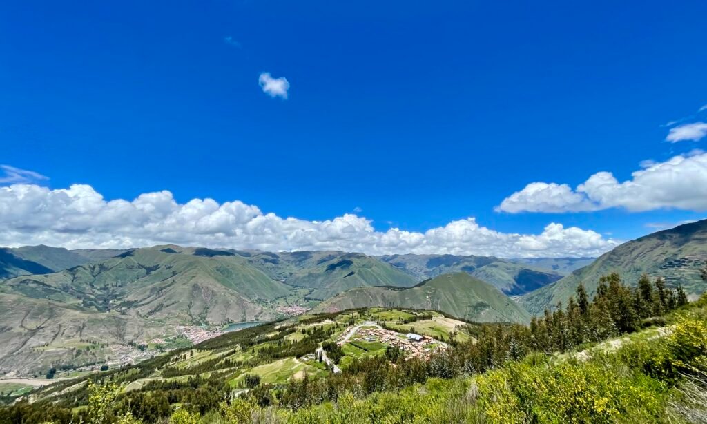
The 30C
By 2:00 AM, I was slamming a coffee. By 3:00 AM, we were on the 30C Interoceanic Highway. The drive out of the city is a deceptive descent, but then the climb begins.
The 30C coils. We hit 90-degree and 180-degree bends in a relentless rhythm. You don’t just sit in a car at this elevation; you fight to stay upright.
My right hip began to seize from the bracing, and every bend threw my weight sideways as I fought the momentum of the mountainside. At Tinki, sitting at 4,200 meters, the sun didn’t feel like a source of warmth.
It felt like a hangover. It was a piercing, aggressive brightness that made the world look too sharp. I had to buy cheap leggings from a local vendor because the damp cold was cutting straight through my pants. “Jungle-grade” gear is useless at 4,000 meters.
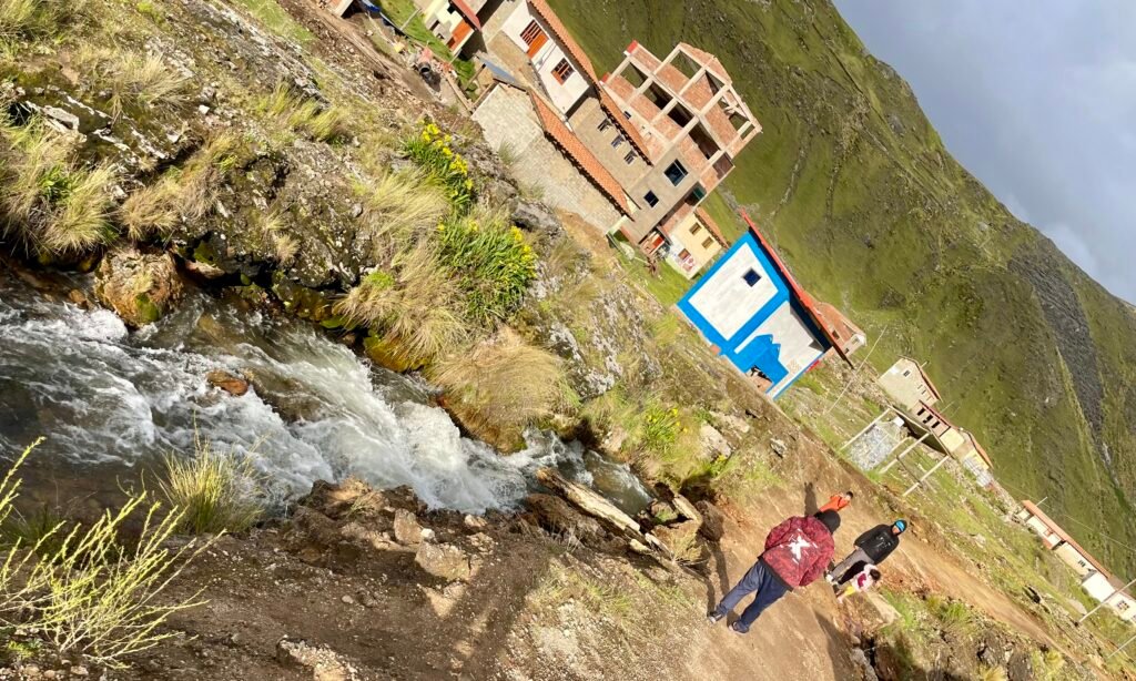
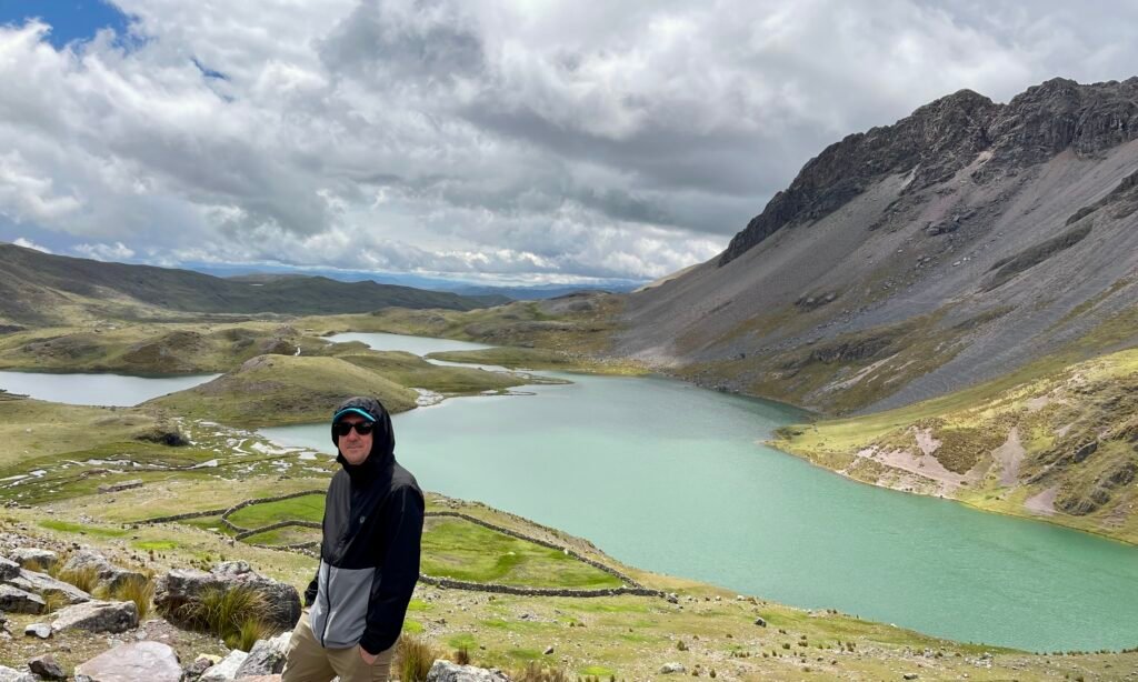
Pacchanta
The trailhead at 4,310 meters starts with the sound of rushing water—a deep, grounding roar that finally killed the elevator music in my head. We stood there for a moment in the cold morning air, watching the steam rise off the hot springs.
A local woman moved past us, walking at a steady, effortless pace that made our deliberate breathing feel theatrical. The peace was short-lived. A group of day-trippers marched past, cameras clicking at nothing, while one traveler loudly announced “facts” to a companion.
He was desperate to perform expertise in a place that makes fools of everyone. As we climbed past 4,500 meters, the stabbing pain started. It was a sharp, localized spike of pain just above my left eye.
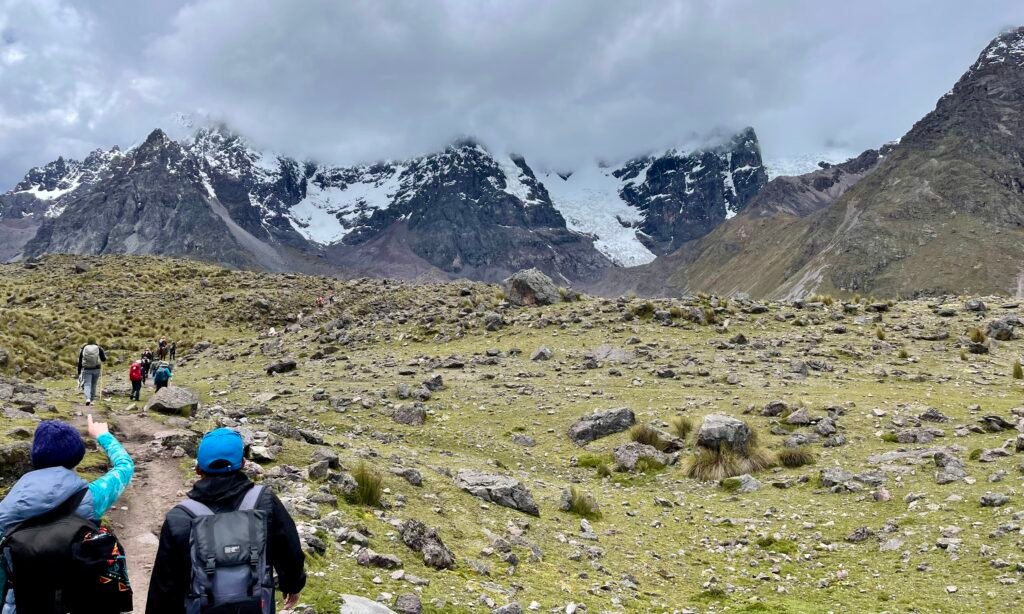
It didn’t thump with my pulse; it just sat there, widening as the oxygen disappeared. This was sea level to over 5,000 meters in under twelve hours. My thighs began to burn.
My back was a map of knots. I started taking deep, conscious breaths—trying to swallow the air rather than breathe it.
The Shack at 5,000m
We passed people on “emergency horses” hired from questionable guides. These people looked checked out, their eyes glazed, clinging to animals that could bolt the moment a viscacha hopped across the trail.
Above them, a group was floating flowers into a lake while a pseudo-shaman clutched a murky plastic bottle. It smelled of burnt Palo Santo, and cultural appropriation. There was a desperate, plastic artificiality to the scene that felt entirely separate from the mountain we were actually standing on.

I finally hit 5,000 meters and found a sheltered shack. I sat down and zoned out. The face of Ausangate was right there—a jagged, blindingly white wall of ice that seemed to vibrate in the thin air.
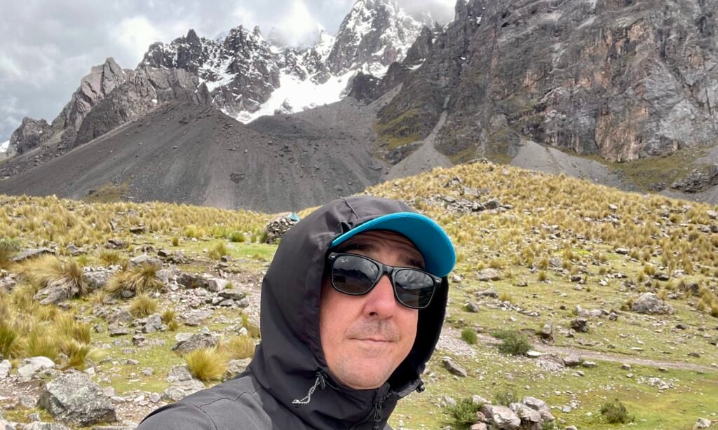
I pulled out my phone to record the view, but when I played it back later, I was just babbling about the lack of a beer lady at the summit. My brain was tracking the landscape, but it wasn’t tracking reality.
The Weight of Abra Pirhuayani
Dropping back down to the hot springs at Pacchanta felt like a slow-motion recovery. The sulfur water hit my pink, swollen extremities and the stabbing pain dimmed to a dull hum.
We sat in the water in silence, watching the clouds snag on the peaks above. The headache was still there, but it had stabilized into a manageable vibration. Yet the mountains weren’t done.
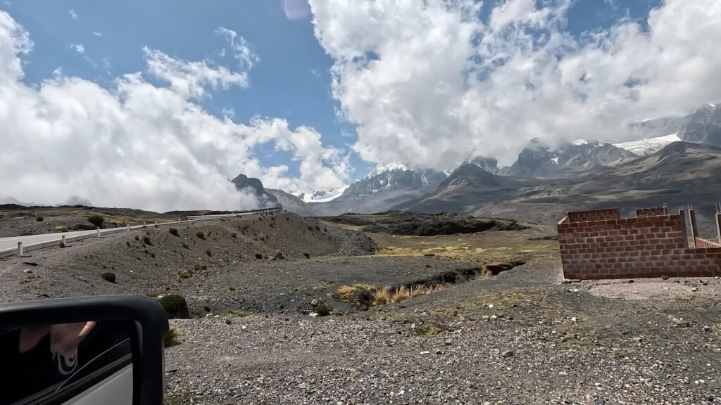
The next day, as we drove over Abra Pirhuayani at 4,725 meters, the geography imposed itself again. As the car climbed toward the high point of the pass at around 4,800 meters, it felt like a cold, mechanical weight sitting on my chest—a reminder that even in a car, you cannot bypass the physics of the Andes.
That is the reality the brochures omit. You can’t ‘hack’ this transition. You can pay for the tour and the ceremony, but eventually, the verticality of Peru will find you.
It will spike your head and squeeze your lungs, reminding you that you are just a guest in a place that doesn’t negotiate.
Geography Doesn’t Negotiate
The Andes are indifferent to your itinerary. I’ve already spent the sleepless nights and made the altitude mistakes so you don’t have to. If you want a plan built on the reality of the road rather than the promises of a brochure, let’s get it right.