Most people treat the Amazon like a theme park with a weather app. They search for the “Best Time to Visit” because they want the version from the brochure: bright parrots, dry boots, and a predictable sunset.
But after fifteen years of coming here—and spending the last two as a resident—I’ve realized the “best time” is a myth sold by people who’ve never had to turn back on a flooded road. If you want the truth about Tambopata and Puerto Maldonado, stop looking at the calendar and start looking at how the land actually moves.
The Shift
You don’t know the rainy season’s here because of a calendar entry. You know it because the air suddenly feels like a physical burden.
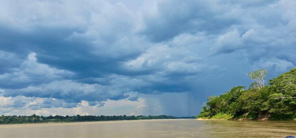
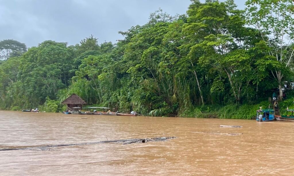
In the weeks before the sky finally breaks, the afternoon thunderstorms build into massive, electric cathedrals that light up the canopy for miles. Then the silt starts to move. The “Sleeping Giants”—the Tambopata and the Madre de Dios—begin to reclaim their banks.
I’ve watched hundred-foot trees, stripped of their branches, drift past in total silence. There’s no roar. Just a heavy, terrifying momentum pushing forest giants toward the Bolivian border. When the river wakes up, it doesn’t shout. It just takes.

The 30C Gamble
Driving down from Cusco in the wet months is basically gambling with the geography.
The descent through the Camanti cloud forest is the easy part—the waterfalls are roaring and everything feels visceral as you drop out of the mountains. But once you clear Santa Rosa, the Andes give up.
The road drops the last few hundred meters and flattens into the basin. From here, past La Pampa and into Puerto Maldonado, the road’s reliability vanishes. Landslides aren’t just a possibility; they’re a schedule.
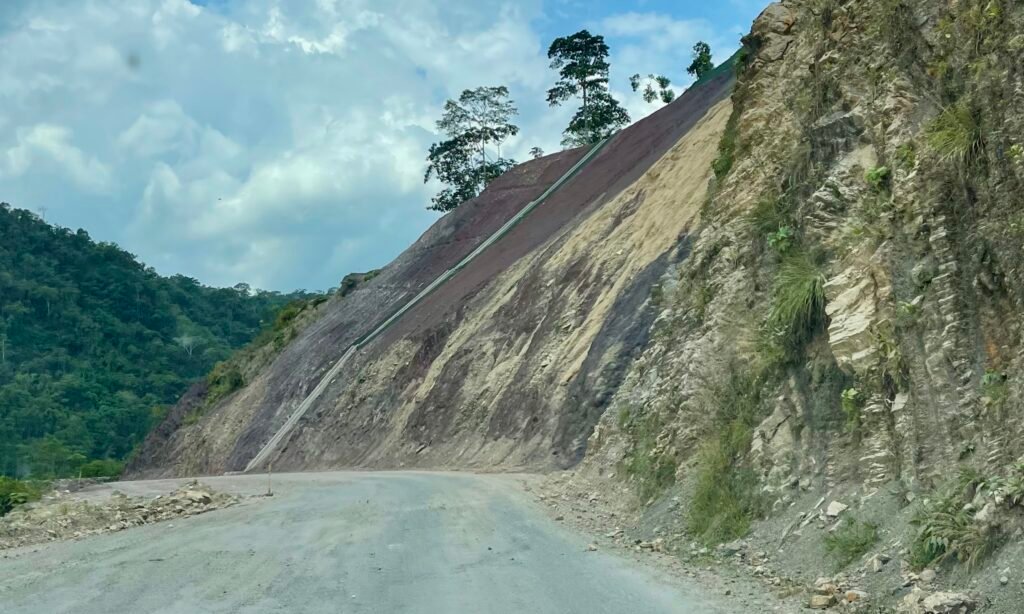
The rain turns the mountain slopes into a slurry, and the road’s usually the first thing to give way. I’ve seen those flatlands go under water until they’re impassable.
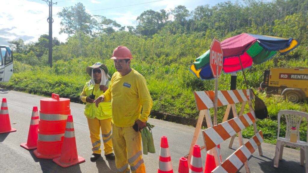
When travelers get stranded, they usually opt for Quincemil and the cloud forest where at least the scenery’s green; otherwise, you’re left in Santa Rosa watching the road ahead disappear into the flood. Turning back to fly from Cusco isn’t “giving up”—it’s simply accepting the terrain’s no longer under your control. (The road into Manu shares this exact same DNA; once the rain hits, the access roads become a lottery you’re likely to lose.)
The Dust and the Hidden River
There’s a dark irony to the road during a deluge. Around the illegal mining hub of La Pampa, the rain kills the suffocating dust that usually chokes the air, making the stretch look “cleaner” than it is.
It’s a lie, obviously. The rising river’s just busy hiding the toxic runoff from the mining camps and moving the mess silently downstream.
The “Friaje” and the Wind
Once you’re on the water, you’re hit with a different kind of volatility. Once a year, a mass of polar air surges up from Antarctica, funneled by the wall of the Andes directly into the basin.
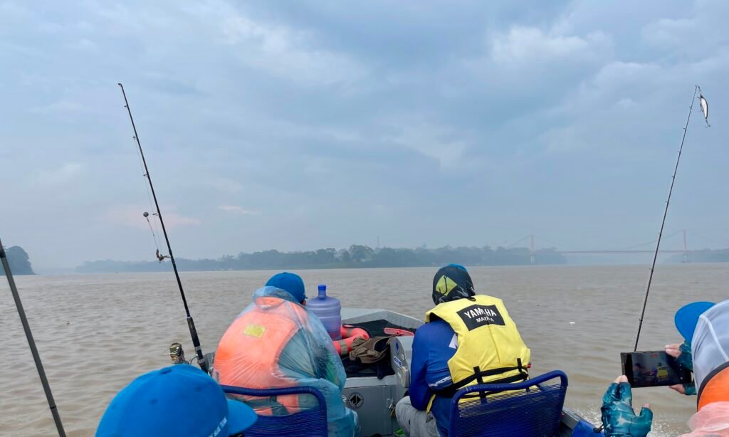
The locals call it a Friaje, and they bundle up as if a blizzard has hit. You’ll probably laugh, especially if you’re from the north. But wait until you’re on a boat powering against the current, soaked to the bone, with a polar wind cutting through your gear.
That wet cold doesn’t just chill you; it pierces you. In the Amazon, you don’t pack for the heat—you pack for the moment the temperature drops 20 degrees in an hour and the jungle turns into a refrigerator.
The Empty Lick
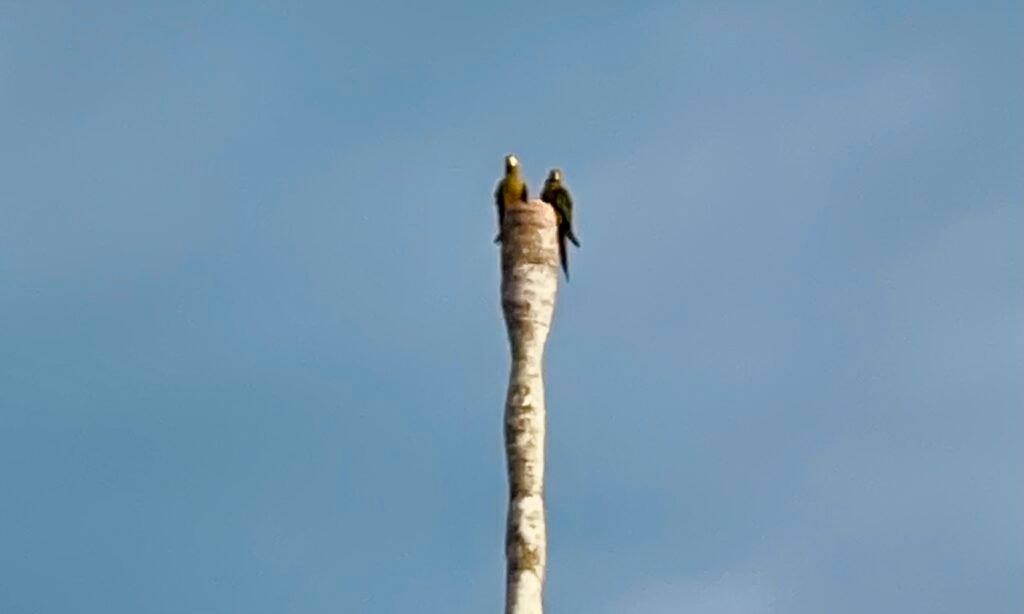
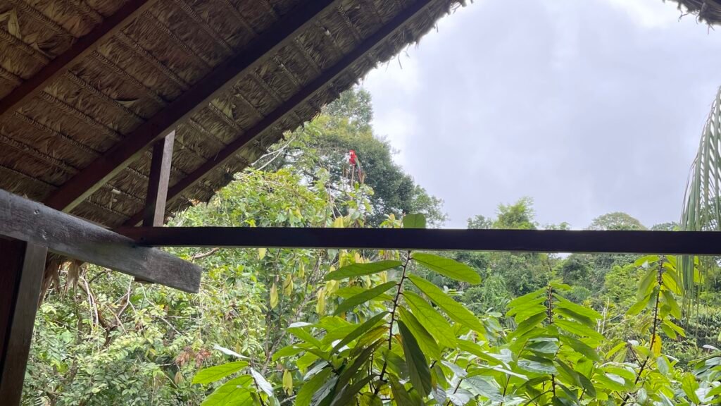
The brochures sell the clay licks as a year-round spectacle. Go in the peak of the rain and you’ll find a yellowish-brown mud wall that looks like an abandoned construction site.
The parrots aren’t stupid. They can smell the rain, and they stay home. You might see a single, bright head sticking out of a grey, carved-out palm trunk—the bird looking out from his house at the foolish humans sitting in the rain and wondering what the hell we’re doing there.
But what you lose at the clay licks, you gain in atmosphere. When the forest floors flood, the jungle becomes a mirror. I’ve watched the water reflect the canopy so perfectly it’s impossible to tell where the river ended and the trees began. The dry-season crackle of leaves is replaced by a symphonic amphibian roar—it’s the sound of a forest that’s finally, fully hydrated.
Where to Stay: Why Proximity is Your Best Friend
In the peak of the rain, I personally prefer lodges closer to town or along the Madre de Dios. If it pours for three days, staying deep in the reserve zone can feel like a prison sentence.
Experienced guides will often refuse to enter the deep forest trails during major storms; they know that when the ground is saturated and the wind picks up, the canopy becomes genuinely dangerous. Falling branches and trees are a lethal reality, and a veteran guide won’t gamble with your life just to check a box on an itinerary.
In a deep-jungle lodge during a storm, you’re relegated to the communal area, getting beaten at chess by a four-year-old while the lodge bar runs out of beer because the supply guy can’t get his boat through the logs.
By staying closer to the confluence of the rivers near Puerto Maldonado, you keep your options open. If the river’s too high, you can retreat to town for a cold beer and the Carnival energy.
There are no lodges near Lake Yacumama, but there are lodges near Lake Sandoval. And being based on the Madre de Dios gives you the flexibility to hit Sandoval or Yacumama as day trips.
Even in a deluge, the oxbow lakes stay open. I’ve even seen river caiman get out of the raging current and lay on the banks just to escape the power of the rising water.
So, When Should You Actually Go?
The Amazon doesn’t have a “bad” time—it only has travelers who are unprepared for the trade-offs.
- First-Time Visitors: Stick to the Dry Season (May–October). The logistics are predictable, but be prepared for company. The peace and serenity of the basin are often replaced by the sound of tour groups, and the forest floors can feel dusty and stripped of their “jungle” vibe.
- Wildlife Photographers: The Shoulder Seasons (April/May & Oct/Nov) offer the best light and active wildlife without the mid-year hordes.
- Birders: The Dry Season is essential for macaw activity at the clay licks, provided you don’t mind sharing the view with twenty other tripods.
- Atmosphere Seekers: The Peak Rainy Season (Jan–Feb) is for the flooded forest mirrors and the Carnival energy in town. It’s the closest I’ve come to feeling alone in the basin. Just stay near the confluence, pack a real windbreaker, and keep your expectations as fluid as the rivers.
Don’t fight the geography. Watch the logs drift toward Bolivia, stay near the confluence of the rivers, and remember: the jungle doesn’t care about your itinerary, and that’s exactly why it’s worth seeing.
Geography Doesn’t Negotiate
When the rivers wake up and the roads into the basin vanish, your trip depends on who is making the calls. I’ve spent more than fifteen years building a network of expert guides and veteran partners who understand the reality of the Amazon. If you want a plan backed by people who know when to push and when to wait, let’s talk.